LiDAR Scanning Services in Phoenix

    High-precision laser measurement for large-scale projects

    LiDAR (Light Detection and Ranging) technology enables precise measurement of large areas, outdoor structures, and complex environments in the Phoenix area.

    LiDAR scanning equipment on tripod capturing outdoor industrial site data with Phoenix mountains in background at golden hour

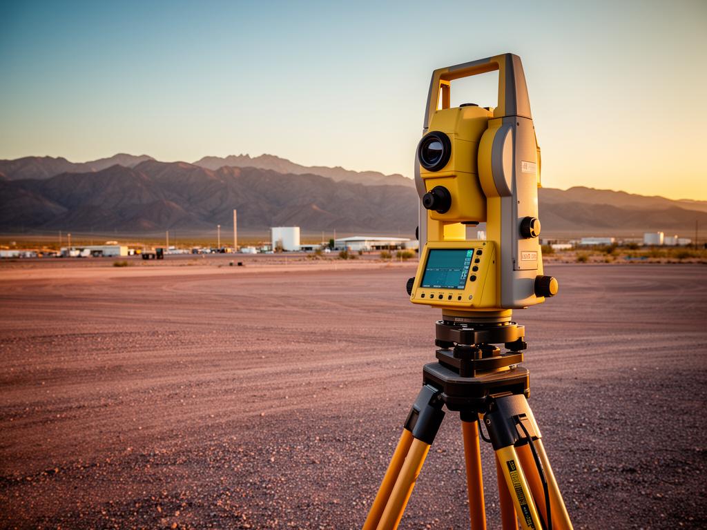
    What is LiDAR Scanning?

    LiDAR (Light Detection and Ranging) is a remote sensing technology that uses laser pulses to measure distances and create precise three-dimensional representations of physical spaces. LiDAR scanners emit thousands to millions of laser pulses per second, measuring the time it takes for each pulse to return after hitting a surface.

    LiDAR scanning is particularly effective for large-scale projects, outdoor environments, and situations where traditional scanning methods are impractical. The technology works well over long distances (up to several hundred meters) and can capture data in challenging conditions including varying lighting and reflective surfaces.

    In Phoenix, LiDAR scanning is commonly used for site surveys, infrastructure projects, large industrial facilities, and outdoor structure documentation. The data can be used for topographic mapping, volume calculations, site planning, and integration with GIS systems.

    Common Applications

    • Site topography and terrain mapping
    • Large industrial facility documentation
    • Infrastructure and roadway projects
    • Outdoor structure measurement
    • Construction site monitoring
    • Volume calculations for stockpiles or excavations

    Our LiDAR scanning services provide non-certified informational deliverables. For survey-grade certified measurements, we can recommend licensed surveyors.

    Benefits of LiDAR Scanning Services

    Long-Range Capability

    Capture accurate measurements at distances up to 300+ meters, making LiDAR ideal for large sites and outdoor environments.

    Rapid Data Capture

    Cover large areas quickly. LiDAR can scan entire sites in a fraction of the time required for traditional surveying methods.

    Works in Challenging Conditions

    LiDAR performs well in various lighting conditions and can capture data from reflective or difficult surfaces.

    GIS Integration

    LiDAR data integrates seamlessly with Geographic Information Systems (GIS) for mapping, analysis, and spatial planning.

    Precise Elevation Data

    Capture detailed terrain and elevation information for grading plans, drainage analysis, and site development.

    Safe Data Collection

    Scan dangerous or hard-to-reach areas without putting personnel at risk. Ideal for active construction sites or industrial environments.

    Our LiDAR Scanning Services Process

    1

    Project Scoping

    We discuss your project requirements, site conditions, required accuracy, and deliverable needs. We determine the optimal scanning approach for your specific project.

    2

    Site Preparation

    If needed, we establish control points or targets for georeferencing. We coordinate with site personnel for safe access to all areas.

    3

    LiDAR Data Capture

    Our team captures comprehensive LiDAR data from strategic positions across your site. We verify coverage and data quality on-site.

    4

    Data Processing

    We register all scan positions, clean the data, and create a unified point cloud. For GIS projects, we georeference to your coordinate system.

    5

    Deliverable Creation

    We produce the agreed deliverables: point clouds, surface models, topographic maps, CAD drawings, or GIS-ready files.

    LiDAR Scanning Services Use Cases

    Site Surveys & Topography

    Capture detailed terrain data for site planning, grading design, and construction documentation. Faster than traditional surveying for large areas.

    Industrial Facility Mapping

    Document large industrial complexes including outdoor equipment, piping, and infrastructure. Support maintenance planning and facility modifications.

    Infrastructure Projects

    Scan roadways, bridges, utilities, and transportation infrastructure for condition assessment, renovation planning, or as-built documentation.

    Construction Site Monitoring

    Track construction progress with periodic LiDAR scans. Compare actual conditions to design for quality assurance and progress reporting.

    Volume Calculations

    Calculate stockpile volumes, excavation quantities, or fill requirements with high accuracy. Support material management and billing verification.

    Solar Installation Planning

    Document rooftops and site conditions for solar panel installation planning. Accurate measurements support system design and installation.

    LiDAR Scanning Services Pricing Factors

    LiDAR project cost varies based on project scope and requirements:

    Site Size & Coverage Area

    Larger sites require more scan positions and longer field time. Very large sites may require multiple days of data capture.

    Accuracy Requirements

    Higher accuracy requirements may necessitate additional control points and more detailed scanning methodology.

    Terrain & Accessibility

    Difficult terrain, limited access, or safety requirements can increase project complexity and time.

    Deliverable Complexity

    Raw point cloud delivery is less expensive than projects requiring topographic maps, surface models, or CAD drawings.

    Typical project investment: LiDAR scanning projects in Phoenix typically range from $2,500-$12,000+ depending on site size and deliverable requirements. Large infrastructure or multi-site projects may exceed this range.

    Frequently Asked Questions

    Request a LiDAR Scanning Services Quote

    Get a detailed proposal for your Phoenix-area project. We typically respond within one business day.